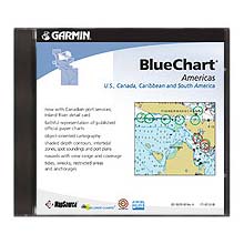


MapSource BlueChart is Garmin's exclusive marine cartography. It was developed to provide mapping flexibility and options you've never had before. BlueChart CD-ROMs provide the same detailed, object-oriented cartography as the pre-programmed BlueChart data cards, including specific region breakdowns.
Version 9 features include:
- New! Now with new coverage of Newfoundland, Labrador and Hudson Bay
- Includes Canadian port services; Inland River detail card
- Includes Wavey line data for the Turks and Caicos Islands in addition to data from Explorer Charts for the Bahamas
- Bathymetric data for East Coast and Gulf of Mexico
- Updated coverage of U.S., Canada, Caribbean and South America
- Trip and waypoint management functions
- Detailed electronic nautical charts for several pre-defined regions in the specifiied area -- select the offshore region of your choice
- Shaded depth contours and intertidal zones with spot soundings
- Navaids with view range and coverage
- Chart information such as chart name, number, scale, revision date, and latest Notice to Mariners
- Wrecks, restricted areas, cable areas, anchorages, shoals, and spoilage
- Americas version contains tides and port plans / contact information for local ports and marinas
Unlocking your coverage:
Coverage is broken down into different regions. A region must be unlocked prior to use. With the purchase of MapSource BlueChart CD ROM, customers will have access to one region area of their choice. The region can be unlocked through Garmin via their web site or by phone. You can reprogram the data card whenever you want by simply downloading different areas.